7 Days Machame Route Kilimanjaro Trek
7 Days Machame Route Trek Overview
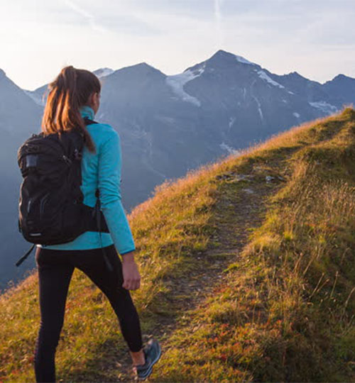
The 7 Days Machame Route stands out as one of the best Kilimanjaro routes. It offers a well-balanced combination of physical challenge, beautiful scenery, and time to acclimatize making it one of the most popular choices for trekkers.
The route’s gradual ascent profile allows your body more time to adjust to the altitude, which significantly increases your chances of a successful summit.
Whether you’re an experienced hiker or a determined first-time climber, the 7 Days Machame Route offers the ultimate Kilimanjaro experience: demanding but rewarding, wild yet achievable, and always breathtaking.
What Makes the 7 Days Machame Route a Top Choice?
Gradual Ascent for Better Acclimatization
The 7-day itinerary is designed with altitude adjustment in mind. The extra day on the trail allows your body to acclimatize more naturally, which dramatically improves your chances of reaching Uhuru Peak safely and successfully.
Diverse and Breathtaking Scenery
From lush rainforest trails and moorlands to surreal alpine deserts and the icy summit zone, the 7 Days Machame Route takes you through all of Kilimanjaro’s ecological zones offering unmatched visual variety and photographic opportunities.
Authentic Kilimanjaro Camping Experience
Spend each night under a canopy of stars, surrounded by the raw beauty of the mountain. All camps are set up and managed by your crew, so you can focus on resting and soaking in the adventure.
Day 1: Machame Gate to Machame Camp
-Elevation: 1800M amsl to 2835M amsl
-Distance: 11 km/7 miles
-Hiking Time: 5-7 hours
-Habitat: Montane Forest
The drive from Moshi to the Machame Gate takes about 50 minutes. The journey passes through the village of Machame which is located on the lower slopes of the mountain. As we leave the park gate, we walk through the dense rain forest on a winding trail up a ridge until we reach the Machame Camp.
Day 2:Machame Camp to Shira Cave
-Elevation: 2835M amsl to 3750M amsl.
–Distance: 5 km/3 miles
-Hiking Time: 4-6 hours
-Habitat: Moorland
We leave the glades of the rain forest and continue on an ascending path up to a steep, rocky ridge. On the Shira Plateau, we pass through heather and open moorlands, then cross a large river gorge to Shira Cave.
Day 3: Shira Cave to Lava Tower
-Elevation: 3750M amsl to 4600M amsl
-Distance: 7 km/4 miles
-Hiking Time: 4-5 hours
-Habitat: Moorland
Lava Tower to Barranco Camp
-Elevation: 4600M amsl to 3900M amsl
-Distance: 3 km/2 miles
-Hiking Time: 2-3 hours
-Habitat: Alpine Desert
We continue to the east up a ridge and then head southeast towards the Lava Tower – a 300 ft tall volcanic rock formation. We descend down to Barranco Camp through the strange but beautiful Senecio Forest to an altitude of 13,000 ft. Although you begin and end the day at the same elevation, the time spent at higher altitude is very beneficial for acclimatization.
Day 4: Barranco Camp to Karanga Camp
-Elevation: 3900M amsl to 3995M amsl
-Distance: 5 km/3 miles
-Hiking Time: 4-5 hours
-Habitat: Moorland
We begin the day by descending into a ravine to the base of the Great Barranco Wall. Then we climb the non-technical but steep, nearly 900 ft cliff. From the top of the Barranco Wall we cross a series of hills and valleys until we descend sharply into Karanga Valley. One more steep climb up leads us to Karanga Camp. This is a shorter day meant for acclimatization.
Day 5: Karanga Camp to Barafu Camp
-Elevation: 3995M amsl to 4673M amsl
-Distance: 4 km/2 miles
-Hiking Time: 4-5 hours
-Habitat: Alpine Desert
We leave Karanga and hit the junction which connects with the Mweka Trail. We continue up to the rocky section to Barafu Hut. At this point, you have completed the Southern Circuit, which offers views of the summit from many different angles. Here we make camp, rest and enjoy an early dinner to prepare for the summit day. The two peaks of Mawenzi and Kibo are viewable from this position.
Day 6: Barafu Camp to Uhuru Peak
-Elevation: 4673M amsl to 5895M amsl.
-Distance: 5 km/3 miles
-Hiking Time: 7-8 hours
-Habitat: Alpine Desert
Uhuru Peak to Mweka Camp
-Elevation: 5895M amsl to 3100M amsl
-Distance: 12 km/7 miles
-Hiking Time: 4-6 hours
-Habitat: Ice Cap
Very early in the morning (around midnight), we begin our push to the summit. This is the most mentally and physically challenging portion of the trek. The wind and cold at this elevation and time of day can be extreme.
We ascend in the darkness for several hours while taking frequent, but short, breaks. Near Stella Point (18,900 ft), you will be rewarded with the most magnificent sunrise you are ever likely to see coming over Mawenzi Peak.
Finally, we arrive at Uhuru Peak- the highest point on Mount Kilimanjaro and the continent of Africa.
From the summit, we now make our descent continuing straight down to the Mweka Hut camp site, stopping at Barafu for lunch. The trail is very rocky and can be quite hard on the knees; trekking poles are helpful. Mweka Camp is situated in the upper forest and mist or rain can be expected in the late afternoon.
Later in the evening, we enjoy our last dinner on the mountain and a well-earned sleep.
Day 7: Mweka Camp to Mweka Gate
-Elevation: 3100M amsl to 1640M amsl
-Distance: 10 km/6 miles
-Hiking Time: 3-4 hours
-Habitat: Moorland/Montane Forest
On our last day, we continue the descent to Mweka Gate and collect the summit certificates. At lower elevations, it can be wet and muddy.
From the gate, we continue another hour to Mweka Village. A vehicle will meet us at Mweka Village to drive us back to the hotel in Moshi.
What’s Included
- Licensed professional guides with wilderness first aid training
- Friendly, experienced porters and a personal cook
- Park fees, rescue fees, and government taxes
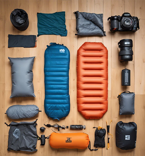
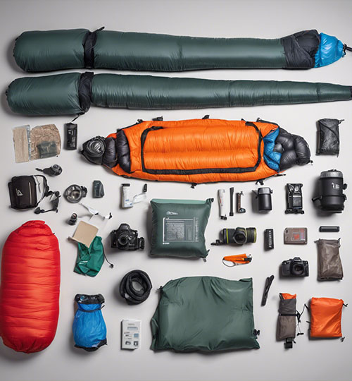
- All camping equipment (tents, sleeping mats, mess tent)
- Meals during the trek (breakfast, lunch, dinner)
- Clean drinking water throughout the climb
- 2 nights hotel accommodation in Moshi (before & after the trek)
- Airport transfers to and from Kilimanjaro International Airport (JRO)
Not Included
- International airfare
- Tanzania entry visa
- Travel insurance (required)
- Tips for crew (guides, porters, cook)
- Personal trekking gear (available for rent in Moshi)
Machame Route Key Scenic Highlights
Shira Plateau
The Shira Plateau is one of the highlights of the 7 Days Machame Route, offering expansive, high-altitude terrain with sweeping views of Kilimanjaro’s majestic western slopes.
- Overview: The Shira Plateau is a high-altitude area that provides panoramic views of Kilimanjaro’s western flank.
- Experience: As you hike through this area, you’ll encounter unique flora and stunning vistas, including views of Mount Meru in the distance.
- Tip: Take time to enjoy the sunset here; it’s a photographer’s paradise!
Lava Tower
- Elevation: Standing at 4,630 m (15,190 ft), Lava Tower is a prominent landmark along the route.
- Characteristics: This volcanic rock formation offers dramatic scenery and serves as a great acclimatization stop.
- Experience: The views from Lava Tower are spectacular, providing a unique perspective of the surrounding landscape.
Barranco Wall
- Overview: The Barranco Wall is a steep ascent that challenges climbers but rewards them with breathtaking views.
- Experience: As you climb this rocky wall, you’ll witness stunning panoramas of the valleys below and the towering peaks above.
- Quote: “The climb up Barranco Wall is not just a test of strength but a journey through some of Kilimanjaro’s most beautiful landscapes.” – Kilihighlands Explorer Team
Karanga Valley
- Overview: This lush valley is known for its vibrant vegetation and unique wildlife.
- Experience: The contrast between the green valley and the arid landscapes above offers a refreshing change of scenery.
- Tip: Take a moment to relax and soak in the beauty before continuing your ascent.
Barafu Camp
- Elevation: Located at 4,673 m (15,331 ft), Barafu Camp is the last stop before summiting Uhuru Peak.
- Characteristics: The camp provides stunning views of both Kibo and Mawenzi peaks.
- Experience: Watching the sunrise from Barafu Camp is an unforgettable experience that prepares you for your final push to the summit.
Why Choose the Machame Route?
Scenic Diversity
Enjoy ever-changing landscapes as you hike through rainforest, moorland, alpine desert, and the glaciated summit zone.
Better Acclimatization
This 7-day itinerary follows the “climb high, sleep low” principle, giving your body time to adjust to altitude.
Challenge & Reward
The trail is steeper and more demanding than the Marangu Route but offers a more immersive and adventurous climb.
High Summit Success Rate
With its gradual ascent and extra acclimatization day, the 7 Days Machame Route boasts one of the highest success rates on Kilimanjaro.

How does the Machame Route's terrain vary throughout the climb
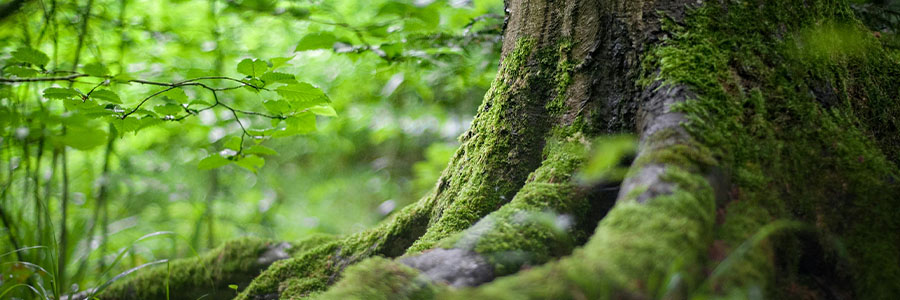
1. Rainforest Zone
The rainforest is lush with dense vegetation, towering trees, and vibrant biodiversity.
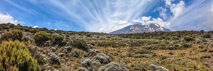
2. Moorland Zone
As you ascend to 3,000 meters, the rainforest gives way to the moorland zone with low brush, heather, and rocky ground.
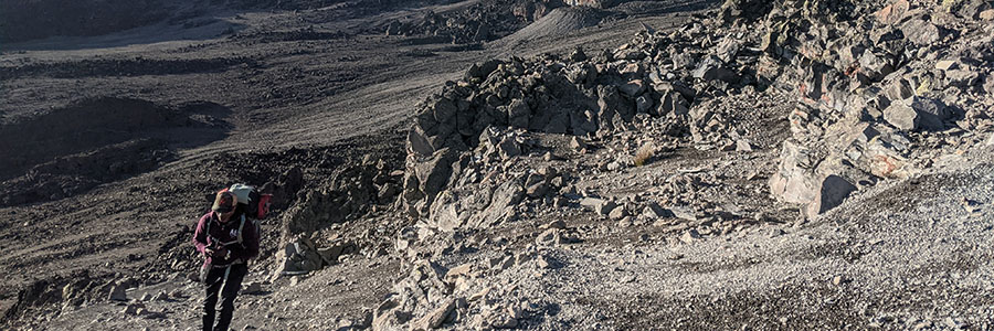
3. Alpine Desert Zone
At around 4,000 meters, the alpine desert zone brings sparse vegetation, rocky trails, and sharp elevation changes.

High Alpine Zone
This zone includes iconic landmarks like Lava Tower (4,630 m) and the steep Barranco Wall. Its rugged terrain and dramatic ascents reveal stunning views of Kilimanjaro’s unique geology.
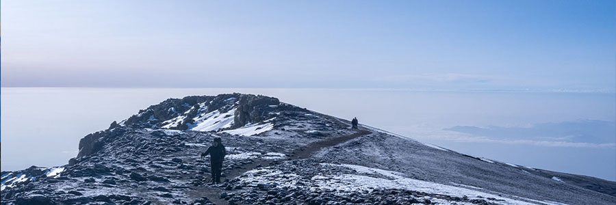
Glacial Zone
Near the summit at 5,895 meters, climbers enter the glacial zone with ice, snow, and freezing temperatures. This harsh, awe-inspiring terrain signals the final push to Kilimanjaro’s peak.
Preparing for Your Kilimanjaro Trek
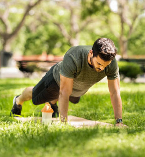
Fitness Tips:
• Begin a regular training routine at least 6–8 weeks before your trek.
• Focus on cardio (hiking, stair climbing, cycling) and leg strength.
• Practice walking with a daypack similar to what you’ll carry on the mountain.
• Simulate longer hikes over uneven terrain when possible.
Packing Essentials:
• Broken-in waterproof hiking boots
•Warm clothing: thermals, fleece, down jacket
• Waterproof outer layers
• High-quality sleeping bag (-10°C or colder)
• Headlamp, trekking poles, gloves, and beanie
• Sunglasses, sunscreen, and lip balm
• Refillable water bottles and hydration pack
Why Trek the 7 Days Machame Route With Us?
- 10+ Years of Experience: We’ve guided hundreds of climbers safely to the summit.
- Small Groups, Big Care: Personalized service with attention to your pace and well-being.
- Ethical Climbing: We pay our team fair wages, and give back to the community in form of supporting community education programs
- Safety First: Pulse oximeter checks, first aid kits, and trained guides ensure your health is always the priority.
Ready to the 7 Days Machame Route?
Fill out our Inquiry Form to get started or schedule a free consultation with our Kilimanjaro trekking experts.
Frequently Asked Questions About 7 Days Machame Route Climb
How difficult is the 7 Days Machame Route?
It’s moderately challenging, suitable for fit trekkers who want a rewarding adventure with steep sections and varied terrain.
How long does the climb take?
This itinerary takes seven days, allowing for proper acclimatization and a higher chance of reaching the summit.
Do I need previous mountain climbing experience?
No prior experience is necessary, but good physical fitness and stamina are important.
What happens if I get altitude sickness?
Your guides are trained in altitude sickness management. Mild symptoms are common, but we carry oxygen and monitor your condition closely. Evacuation support is available if needed.
Can I rent gear in Moshi?
Yes, we provide quality rental equipment, including jackets, boots, sleeping bags, and poles.
When is the best time to trek the 7 Days Machame Route?
The dry seasons which are June to October and January to March, offer the best weather and trail conditions.
What kind of accommodation is provided?
During your 7 Days Machame Route climb you will camp in tents each night, with crew setting up comfortable campsites along the route.
What is the success rate for the 7 Days Machame Route?
With proper acclimatization and support, the 7 Days Machame Route offers one of the highest summit success rates on Kilimanjaro.
Is the 7 Days Machame Route good for first-time climbers?
Yes, the 7 Days Machame Route is a great choice for first-time climbers due to its gradual ascent and scenic acclimatization profile.
Do I need a guide for the 7 Days Machame Route?
Yes, Tanzanian regulations require a licensed guide for all climbs, including the 7 Days Machame Route.